History of trade and mobility in the South-West
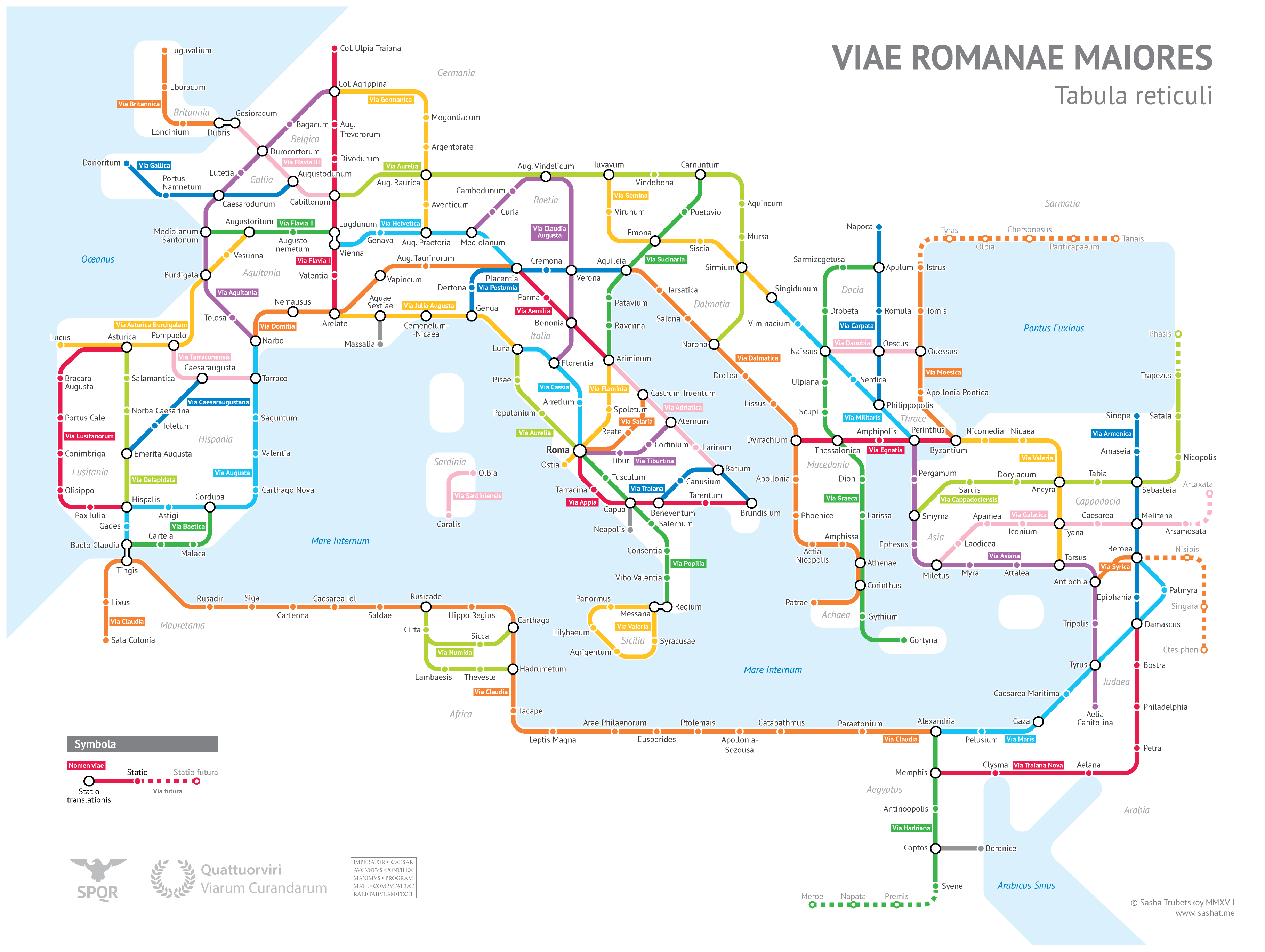
Many people have enjoyed this excellent map, which shows the Roman roads in the style of a metro map.
It's a perfect opportunity to evoke the history of trade and mobility in the South-West over the centuries: as you can see, geography has made the South-West of France the crossroads of South-West Europe. It is the link between the Iberian Peninsula and Northern Europe on the Atlantic seaboard, as well as between the Atlantic and the Mediterranean.
These links are historic, and one of the most spectacular examples is the Canal du Midi, an exceptional 17th-century transport infrastructure, listed as a World Heritage Site, and extended by the Canal Latéral à la Garonne in the 19th century.
This ancient link between the two seas is one of many: the Garonne itself, roads of all ages - Roman (welcome the discovery in 2024 of Roman roads in the Landes, one linking Bordeaux to the Adour and a second linking Bazas to the Adour, on either side of Mont-de-Marsan), Visigothic, Colbertian, Napoleonic or even Pompidolian for cars... - a railway line from 1856, motorways from the 20th century.
The intention for the 21st and 22nd centuries is to modernise these clusters of mobility and exchange links by means of the New South-West Line, which will more than double the capacity for low-carbon mobility, both for long-distance journeys in Europe and France and for day-to-day journeys within the Nouvelle-Aquitaine and Occitanie regions.
The New South-West Line perpetuates a thousand-year-old history, the via Aquitania (Bordeaux-Toulouse-Méditerranée) and the via Asturica Burdigala (Bordeaux-Dax-Spain), for at least the next two centuries.